Archive for the ‘Uncategorized’ Category
Final Elk – Kings Mtns. Post
This is the last post about hiking in the Kings Mountain / Elk Mountain area (at least for the time being). This past Saturday I did the Elk Mountain / Kings Mountain traverse loop: starting at the Kings Mountain trailhead, along the Wilson River Trail to the Elk Creek Campground Trailhead, hiking up Elk Mountain on the “front side”, across to Kings, and back down to the Kings trailhead. Beth and Ruairí joined me on the 3.5 mile Wilson River Trailhead segment, which included the challenge of crossing the creek with the washed-out bridge. I did the remaining 6.5 miles myself.
This was my first time up to the Elk Mountain summit on the “front side”. The only word for this trail was “relentless”. It hardly ever stopped going uphill, straight uphill. It’s as if whoever laid it out had the attitude, “switchbacks, we don’t need no stinkin’ switchbacks”. This can be seen on the elevation profile: in the first ¾ mile, it gains 1500 feet:

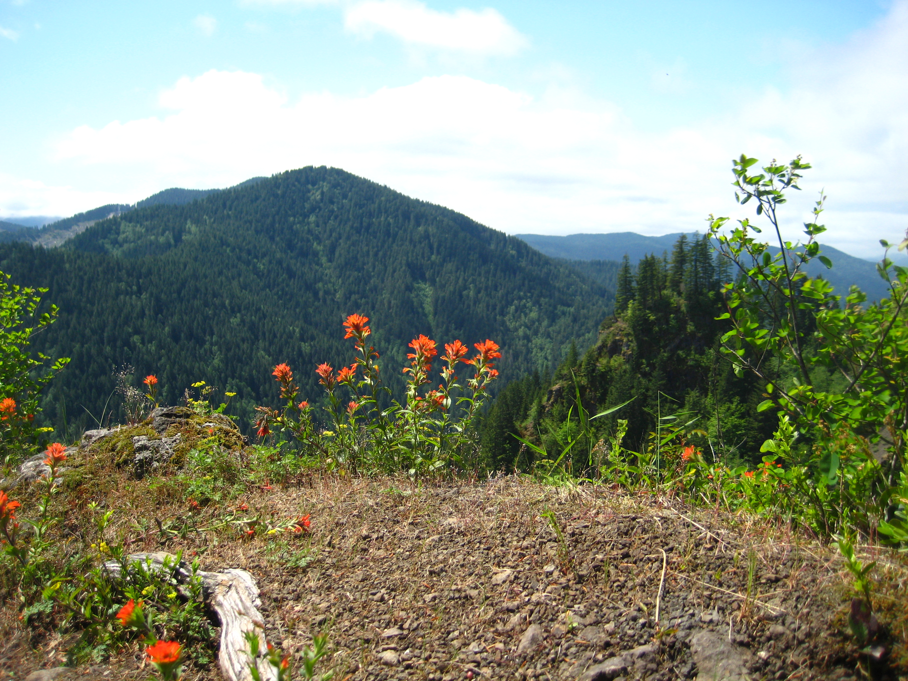
A few more pics follow. This week, the wildflowers were coming into full bloom on the higher meadows, which made for a colorful foreground for the great views in the distance (click on each for a full-size image).


-

- On the summit of Elk Mountain, enjoying a lunch sandwich made with Coyote Creek Ranch egg salad!


-

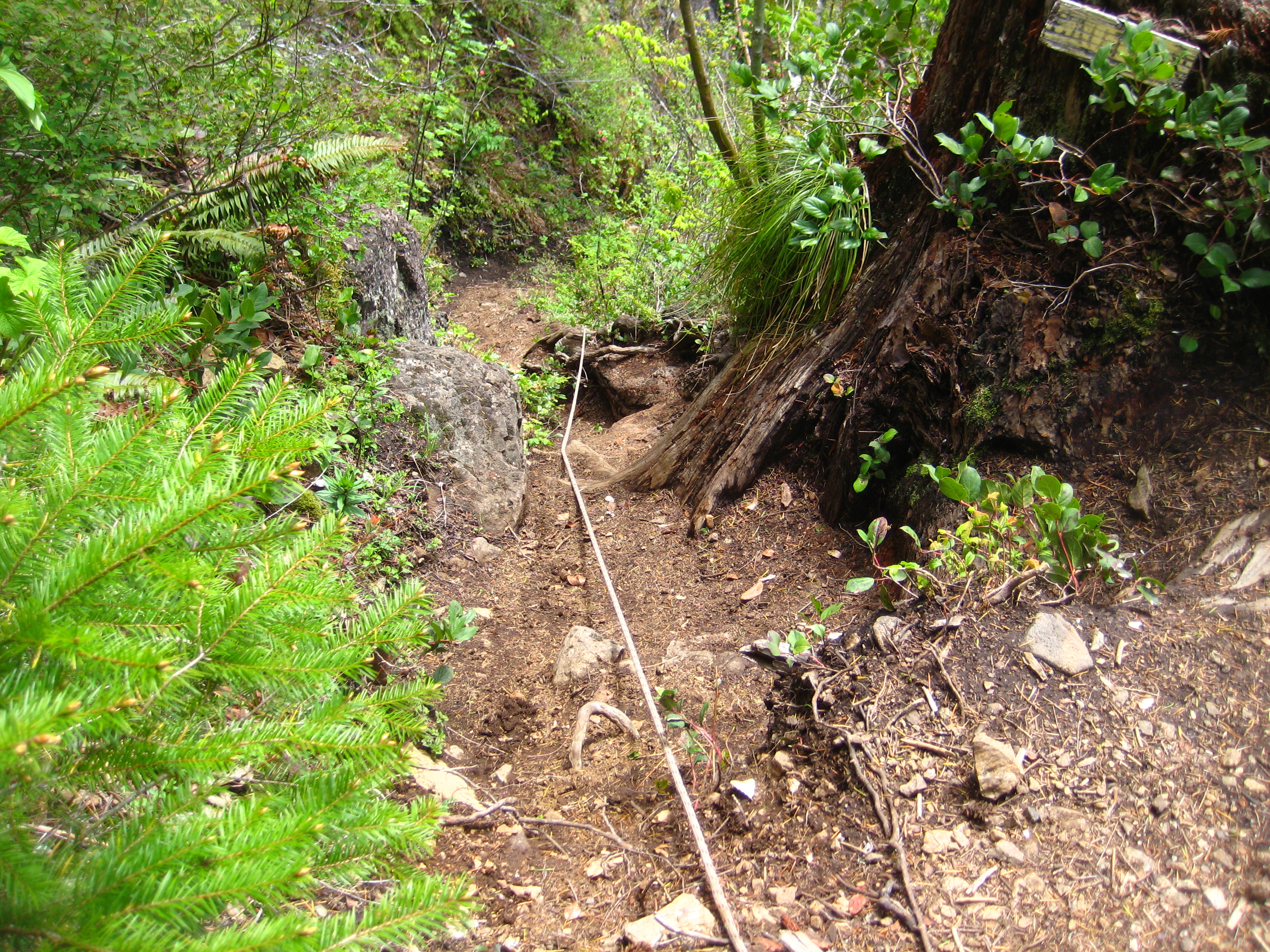
- Another picture of “the rope”. Photos just don’t seem to capture how steep this bit really is.


Elk Mountain Summit
This past weekend I went with one of the groups from Troup 581 doing the King’s Mountain / Elk Creek Trail trip, although I went as a day hike on Saturday only. I went with the group who hiked up the Elk Creek Trail to the Elk Creek Trail / Elk Mountain Trail junction, where the two groups planned to meet up and camp for the night. Since I didn’t get to the Elk Mountain summit during the previous week’s hike, I decided to do it this time. It was 0.8 miles over to the Elk Mountain Trail / Kings Mountain Trail intersection, covering a route I’d done last week. From there it was 2.0 miles to the Elk Mountain summit, approaching from the “back side”.

Those two miles started out fairly easy, being an old abandoned logging road for roughly the first half:

Things changed quickly when the logging road ended. Yes that is the trail, and it runs straight ahead:

Here are a few more pics; click for full-sized originals:


-

- Supposedly this is a view of the prison camp in the Coast Range


Kings Mountain – Elk Creek Trail Trip Report
Hi, Barry here.
On May 12th I “scouted” out the route of the planned Troop 581 Kings Mountain – Elk Creek hiking outing. I started at the Kings Mountain Trailhead, where the more-difficult of the Saturday morning hikes will start (point A on the topo map below). I made my way up Kings Mountain, then down the north side to connect to the Elk Mountain Trail. I then travelled Northwest on the Elk Mountain Trail (i.e., away from the Elk Mountain summit), to the intersection of Elk Mountain Trail and Elk Creek Trail (point E), which is the planned Saturday night camp area. I then followed the Elk Creek Trail down to the Elk Creek Campground (point F), which is the planned Friday night camp area. I then took the Wilson River trail (which parallels Highway 6) back to the Kings Mountain Trailhead. The Wilson River Trail is not shown on the topo map, and is not part of the planned Troop 581 hike.
The trail to the Kings Mountain summit is an excellent, well-maintained trail. Trails in this area have been “adopted” by the Mazama organization, so I guess we have them to thank. The “gotcha” is that it has a challenging elevation gain of about 2500′ along its 2.5 mile length. Almost all of it is wooded, until you arrive at a meadow above the tree line just before the summit. You end up doing alot of switchbacks; the turns tend to be very steep, separated by straight sections that are a bit less so. Just before breaking through the trees you come to a picnic table, built by another BSA troop as an Eagle project (see photo in the gallery below). From there it’s a short hike through the meadow to the sign at the summit. You’re rewarded with fantastic views of the surrounding Coast Range. I did this section in 1 hr 20 minutes, plus a 10 minute fluid-replenishment stop at the picnic table. However, I was only carrying water, lunch, and other Essentials in my day pack; if I was hauling an overnight backpack it would have taken much longer.
The trail up Kings from the south is in great shape, but things changed quickly going down the north side headed over to Elk Mountain. The trail plunges steeply before ascending just as steeply and then joining up with the Elk Mountain trail. This section is only 1.3 miles long, but is clearly the most challenging part of this hike. My GPS recorded slopes of about ±55% in this section. Footing is soft in spots as well. The trail is narrow and stuck to the cliff sides in parts, but unlike some online reports, I never felt any of it was dangerous; I never got that “Oh no if I slip I’m gonna tumble 100’s of feet down this cliff” feeling.
By Point B on the topo map you get to a short, very steep ascent where the Mazamas have placed a rope. This is very helpful, although it would be nice if it was about 20′ longer. 😉 Once you haul yourself up the rope it’s just a short hike before you get to a ridge that pops above the treeline (very windy crossing the ridge). This marks the end of the hardest work in this hike. After a short downhill bit you get to point C on the topo map, where the trail changes from single-dotted line (trail), to double-dotted line (road). From then on the trail is actually an old logging road, and seems like a stroll in a park compared to the previous sections.
Soon you meet up with the Elk Mountain Trail (point D), which in this section is also an easy old logging road. Another 0.8 mile stroll brings you to the intersection with Elk Creek Trail (point E), the planned Saturday camping spot. Just before you get there you encounter a few large snow patches, which would be one possible water source for Saturday night.
Just past Point E there’s a creek shown on the topo map. At first I couldn’t see any sign of it, but in the quiet surroundings I heard the faint gurgling sounds of water, and found a wet spot on the cliff side (see photos in galley below). It would be enough for the inlet of a water filter. In addition, on the Elk Creek Trail just downhill from the Elk Mountain Trail intersection is another small stream, not shown on the topo map, but with alot more water.
There’s not alot of flat camping area in this spot, other than some wide spots on the trail. Ground is hard, mixed gravel/dirt, so staking out tents will be more of a challenge than it is on pure dirt.
The Elk Creek Trail is another old logging road that is now a hiking/mountain biking trail; it’s an uneventful 4 mile hike back to the campground.
The planned Toop 581 hike will end at the Friday night campground (point F) , although I had to hike the 3.5 mile distance on the Wilson River Trail back to the start. The most notable point along that segment is a washed-out footbridge across a large creek (Point G).

Topo Map of the Route, composed of USGS map segments. Click for full-size image.

Elevation Profile for the hike. Section on right is Wilson River Trail (not part of Troop 581 hike). Click for full size image
The Oregon Department of Forestry has put together a very nice brochure with information about these trails. You can download it at: http://www.oregon.gov/ODF/tillamookstateforest/docs/NonMoto_TrailGuides/Kings_Mtn_Elk_Mtn_Trail_v2009.pdf
The following gallery photos were taken along the route, in left→right, top→down order. Click on any photo for a full size image.
-

- Kings Mountain trailhead

-

- Point A


-

- When you see the picnic table, you know the summit is near


-

- Meadow on Kings Mountain summit


-

- Trail down the north side of Kings – much steeper and rougher


-

- The rope by Point B

-

- Caution sign at top of rope section


-

- Point C hiking gets much easier


-

- Point D


-

- Point E

-

- Near Saturday night camping spot

-

- Small stream on hillside near Point E

-

- Close up of water in small stream


-

- Bigger stream, further down Elk Creek Trail

-

- Elk Creek Trail


-

- Almost back to campground; started seeing people again


-

- Start of Wilson River Trail back to Kings Mountain trailhead


-

- Washed out bridge on Wilson River Trail (Point G).


-

- Another (intact) footbridge on flooded meadow

-

- Bridge across Dog Creek

-

- Back to the start (Point H)

Open for Business!
Sunday, May 13th (Mothers’ Day) was the first sale day for Beth and Ruairí’s new farm business! What started back in October with the arrival in the mail of 80+ day-old chicks finally led to the business’ first appearance at this year’s Hillsboro Farmers’ Market in Orenco Station. This weekend they just sold eggs; with plans to add egg salad and deviled eggs next week. The weather was great and the good news was that they sold out!

Vernonia-Banks ½ Marathon and Marathon
Hi, Barry here.
On April 15, 2012 the Oregon Road Runners Club presented this year’s editions of the annual Banks-Vernonia ½ Marathon and Marathon races. Vernonia is about 20 miles north of Banks, at the other end of the Banks-Vernonia Linear Trail. The races did one circuit around Vernonia Lake, and then headed out onto the Trail. The Marathon finished on the track at Banks High School. The Half finished at the Tophill Trailhead, about 8 miles south of Vernonia where the Trail crosses Highway 47.
The ½ Marathon was “walker friendly”, with an early start for walkers and slow runners, one hour ahead of the main field and a maximum time of 4 hours. Lately I’ve been hiking about 13 miles most Saturday mornings, including some steep hills in Stub Stewart State Park; it takes me between 4 and 4½ hours., So I gave the Half a try, hoping to do it in 3:30 or better. I felt good enough at the 10 Mile mark that I was able to jog the last 3 miles, and finished in 2:53:13.
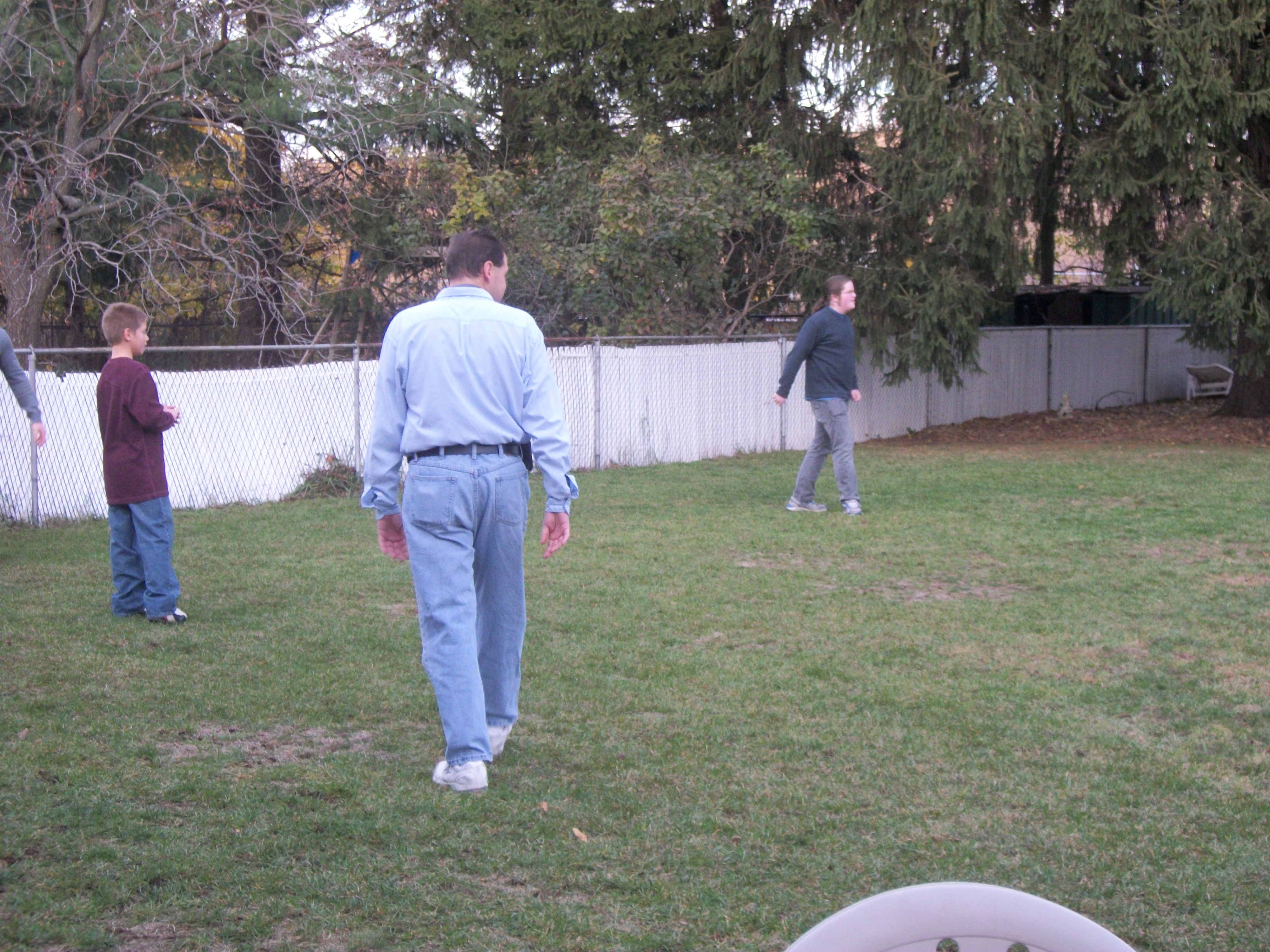
Ruairí snapped this photo of me with 50 yards to go. The morning started out dry but cool, so since I was walking most of the way I wore lightweight long pants and a windbreaker (both bought at the Columbia Employee Store; thanks Thadd):

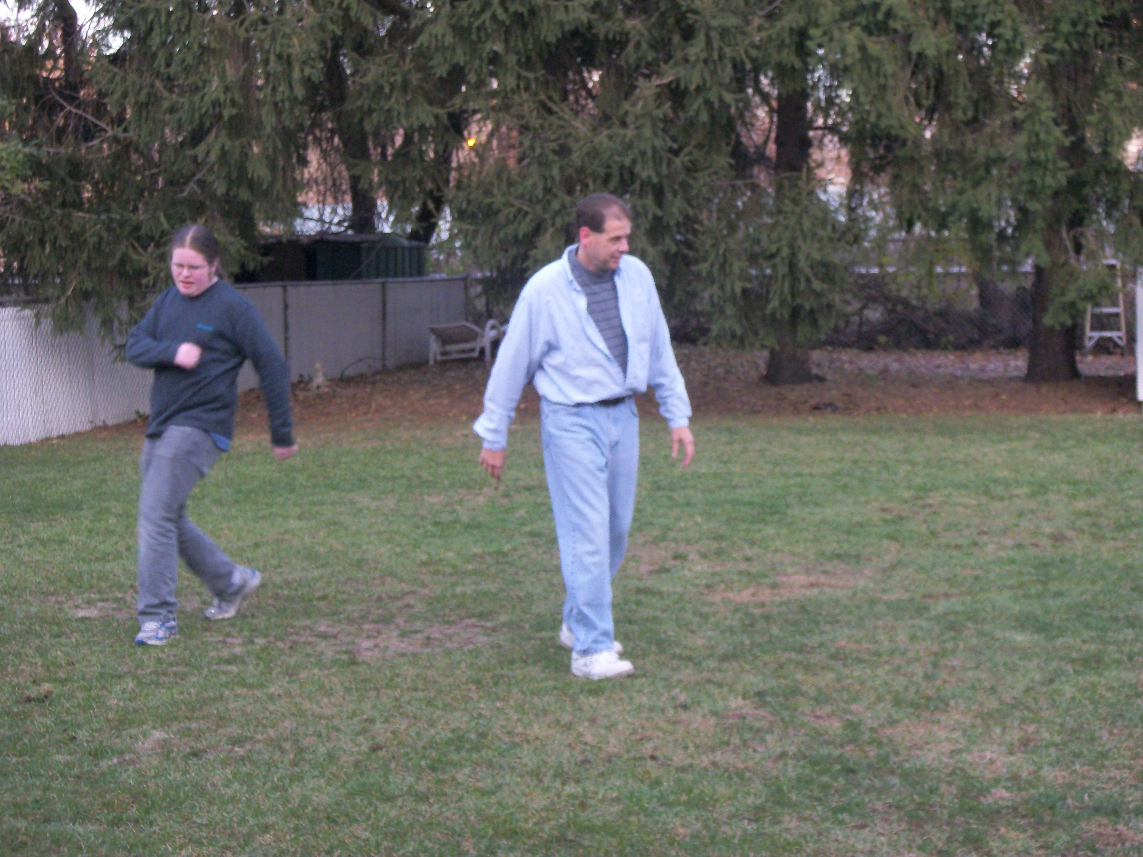
Beth took this one of myself and Ruairí at the finish, with my well-deserved banana:

Next on tap is the Helvetia Half Marathon on June 9. I already have my number for the Portland Marathon on October 7, another “walker friendly” race. Hopefully I’ll eventually be able to jog more than 3 miles at a time. Jogging uses some different muscles than just walking though, and Sunday afternoon and Monday I was pretty sore.
Hillsboro to the MAX!
Ruairí is a member of the Hillsboro Community Youth Choir, a non-profit community youth choir whose mission is “committed to promoting excellence in choral music and is dedicated to enriching the lives of youth by instilling a life-long love of music through performance and education.” During the week of 5 February, 2012, members of the Choir performed the play “Hillsboro to the MAX“, an entertaining musical journey through local history. Ruairí played David Hill, an early pioneer and founder of the city of Hillsboro.
The choir did three performances, including the first in the restored Venetian Theatre, a local favorite in downtown Hillsboro. Here’s a video of Ruairí doing a solo performance of Stephen Foster’s Oh! Susanna, during the third performance at West Union Elementary School:
Trip to NJ for Nana’s 80th Birthday
In mid-November, Beth, Barry and Ruairí travelled to New Jersey for Barry’s Mom’s surprise 80th birthday party

Beth made this video with some of the footage she recorded during the visit; enjoy!
Thumbnails of pics we snapped during the trip. Click on any one for a full-size image:


Down 102 (bye, bye obesity)
Warning: Shameless Boast Ahead

Hi this is Barry. This is a shot of the scale on my weekly weigh-in on November 17, 2011. It notable as this is the first time it’s been below 197 lbs. This means my BMI score was below 30; in other words I waslonger clinically obese. I’m still classified as “overweight”, but this is big change from 8 months ago, when I had a score of 43, “Class III” obesity on the WHO scale, also referred to as “morbid obesity”. That was 90 pounds ago, when I was forced to see a doctor due to my tendon rupture, and I found out what bad shape I had gotten into.

I put on my old pants for this photo. No wonder fitting in restaurant booths was sometimes a challenge.

My sisters found this photo of me in ~1986. Looks like I got a ways to go. 😉

This was the January 27, 2012 weigh-in. More than 100 pounds down from where I started (102 to be exact). The following chart shows the results of a large epidemiological study, and how my predicted health risk has changed as a result:

Body Mass Index vs. All-Causes Mortality*
* From: Berrington de Gonzalez A, Hartge P, Cerhan JR, et al. (December 2010). “Body-Mass Index and Mortality among 1.46 Million White Adults”. N. Engl. J. Med. 363 (23): 2211–9.


Family Xmas presents 2011
End Grain (“Butcher Block”) Cutting Boards
This year’s family presents are end grain cutting boards made from Eastern Hard Maple and Padauk. End grain boards make superior cutting surfaces, as they are very hard and the knife edges tend to go between the wood fibers rather than severing them. We intended thse boards to be used. They are assembled with a waterproof, FDA-approved glue, and finished with food-grade walnut oil. While the glue is waterproof, when cleaning they should just be rinsed and at most only briefly immersed in water. The oil finish will need to be replenished occasionally to maintain it (the walnut oil we used was obtained at Whole Foods).
Research at UC Davis has shown that wooden cutting boards actually discourage bacterial growth better than plastic boards. Apparently, once plastic boards are used a bit, they develop deep scratches that tend to harbor bacteria.
We took a few photos during the project.

Ruairí with the raw material at Crosscut Hardwoods in Portland

Beth's old Subaru does the hauling duty (before it was repaired after its fender-bender).

Pieces milled and cut to length acclimate in the house

Pieces cut into strips before the first glue-up

Boards after the first glue-up, still in the clamps

After the first glue-up, boards are cut into strips again at a 90 degree angle to the first. Alternating strips are then flipped to make the "checkerboard" pattern. Lastly, every board is rotated 90 degrees before glue-up to reveal the end grain surface.

A pile of boards ready to be sanded smooth. Since the end grain surface is so hard, sanding each one was quite of bit of work. Beth and Erin took care of much of it.

Barry and Ruairí apply the walnut oil finish

Beth made a little video while the guys were applying finish: